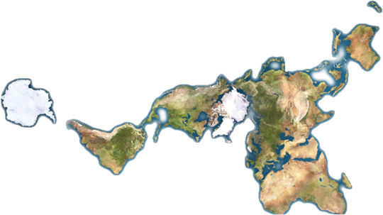
The continents are large areas of crust that make up the solid surface of the Earth. They consist of the comparatively low-density material called sial, and hence tend to float above other crustal material - the sima - in which they are embedded.
On a map of the globe each continent has a very different shape and appearance from the others, and each has its own climate zones and animal life. The geological structure of each one is, however, very much the same.
In its simplest form, a continent is older at the center than at the edges. The old center is known as a craton and it is made up of rocks that were formed several thousand million years ago when the Earth's crust was thinner than it now is. The craton is not involved in any mountain building activity because it is already compact and tightly deformed by ancient mountain building, although the mountains that had been found on it have long since been worn away by the processes of erosion.
Typical cratons include the Canadian Shield, covering northern and central North America, the Baltic Shield in northern Europe and the Siberian Shield in northern Asia. Several smaller cratons exist in South America, India, Africa, Antarctica and Australia.
 The craton is the nucleus of the continent. It is flanked by belts of fold mountains, the oldest being nearer the craton and the youngest farther away. North America provides an excellent example, consisting of the Canadian Shield flanked in the east by the Appalachians and in the west by the Rockies. Close to the shield the Appalachians were formed about 400 million years ago, whereas farther east they were formed about 300 million years ago. The same is true of the mountains to the west, with the main part of the Rockies being about 200 million years old, whereas the coastal ranges are still geologically active today.
The reason for this structure is that when a continent lies at a subduction zone at the boundary between two crustal plates, its mass cannot be drawn down into the higher-density mantle. Instead it crumples up at the edge, the sedimentary areas around the coast being forced up into mountain chains which may be laced through with volcanic material from the plate tectonic activity. These movements may take place several times during a continent's history, with each subsequent mountain chain being attached to the one that was formed previously.
Supercontinents
In reality the situation is much more complicated. As the continents move about on the Earth's surface two may collide with each other and become welded into a single mass. The result is a supercontinent, which has two or more cratons. The weld line between the two original continents is marked by a mountain range that was formed as their coastal ranges came together and crushed up any sediment that may have been between them. Europe and Asia together constitute such a supercontinent, the Urals having been formed when the two main masses came together about 300 million years ago.
On the other hand, a single continental mass may split, becoming two or more smaller continents. This has happened on a grand scale within the last 200 million years. Just before that time all the continents of the Earth's crust had come together, forming one vast temporary supercontinent, known to geologists as Pangaea. Since then the single mass has fragmented into the distribution of continents we know today. Indeed the process is still continuing.
The great Rift Valley of eastern Africa represents the first stage of a movement in which eastern Africa is breaking away from the main African landmass. The slumping structures found at the sides of a rift valley are also seen at the margins of continents that are known to have split away and have not yet been subjected to any marginal mountain-building activity. The eastern coast of South America and the western coast of Africa show such features.
Not all continental masses are above sea level. The Indian Ocean contains many small continental fragments that have sheared off, just as India and Antarctica split away from Africa 200 million years ago. Such fragments include the Agulhas Plateau off South Africa, and the Seychelles and Kerguelen plateau, each with islands representing their highest portions.
Areas of Sedimentation
The other significant feature around the continents is their depositional basins. These are areas that have subsided and may even be below sea level. Because rivers tend to flow into such areas, the basins soon become thickly covered by sediments. The North Sea is an example of a sedimentary basin in northern Europe.
In some areas of the continental margin a large river may flow over the continental shelf and deposit its sediments in the ocean beyond. In such areas the edge of the continental shelf becomes extended beyond that of the rest of the area. The rivers Indus and Ganges produce shelf sediments in the Indian Ocean, and the Amazon and Zaire do the same on opposite sides of the Atlantic.
The actual land area of a continent may also be increased by these means, if the river builds up an extensive delta at its mouth. Considerable land areas have been built up in this way at the mouths of the rivers Mississippi and Niger.