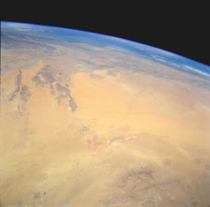
The Great Western Erg, also known as the Western Sand Sea or the Grand Erg Occidental, is full of sharp-crested, smooth-sided sand dunes that stretch out to the horizon like the waves of the sea.
The term "erg" comes from the Arabic word for "large area of sand".
The dune fields of all of the ergs of the Sahara combined make up only about one fifth of the Sahara's total area of around 9 million sq.km (35 million sq.mi). Most of the Sahara, the largest desert in the world consists of monotonous gravel plains, rocky plateaus, arid mountain peaks and salt flats.
 The dunes of the Great Western Erg are formed by the powerful force of the wind. When strong steady winds blow from one direction, the sand piles up into great crescent-shaped dunes, or barchans, that move across the desert. Because the wind direction is constantly changing, the dunes form a complex assortment of shapes. In some places, dunes form long parallel lines separated by broad troughs. In areas, where air currents converge, sand is stacked up into huge mounds or pyramids that can reach 120m (394ft) in height.
Sandstorms
The Great Western Erg is often beset by sandstorms traveling at around 48km (30 mi) an hour. With no obstacles to slow its course, the wind scoops up large quantities of sand, forming a blinding cloud. Without warning, a solid wall of sand, 1.6km (1mi) high and with a front up to 480km (300mi) wide, can appear. Nothing can be seen because the sand blocks out light. All that can be heard is the sound of the battering winds.
A sandstorm is made up of a series of definite layers. From the ground to about waist high, the sandstorm consists of coarse sand and gravel. A layer of thinner sand, which penetrates every crevice, can be found above that. The finest sand and dust whirls high in the air. It can often block out the sun many miles from the heart of the storm.
Sometimes dust from Saharan sandstorms can be carried across the Mediterranean Sea all the way into Southern Europe. After a storm in Algeria in 1947, red Saharan dust turned parts of the Swiss Alps pink.
History of the Sahara Desert
Around 15,000 years ago, when most of North America and Europe were in the midst of an ice age, the Sahara was rich and fertile, with rolling plains and lush grasslands that were populated with large animal herds. The cave paintings of prehistoric human beings who lived there show the land to have been a hunter's paradise.
Later on, as the climate changed and the glaciers receded, moisture-laden air currents from the Atlantic Ocean moved north and rain began to fall over Europe instead of Africa. The Sahara became dominated by dry winds, and its streams and rivers disappeared.
The sand in the Great Western Erg was left over from the previous wet period when rivers and streams washed huge quantities of sand, soil and sediment from the mountains to the north. When there was no longer to any moisture to bind the soil together, it broke down and lost its fertility. In a small amount of time geologically, the rich soil turned into a sea of sand.
Today it hardly ever rains at all in the Sahara. When it does rain, the rain lasts only a few hours.
Over the past 3 million years, the Sahara has had alternating wet and dry periods, just as the northern hemisphere has experienced a cycle of ice ages. Study of the long-term weather patterns of the Earth suggests that eventually the Sahara will experience another wet, fertile period.